
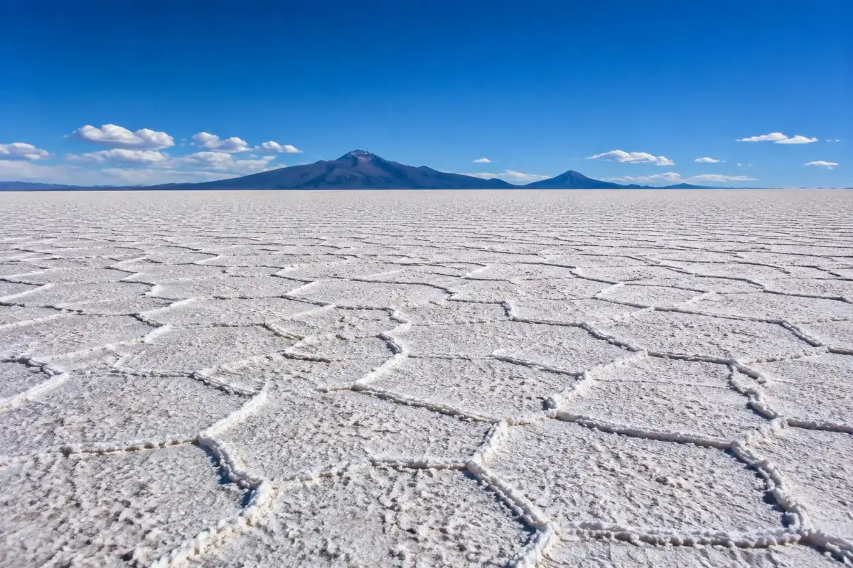
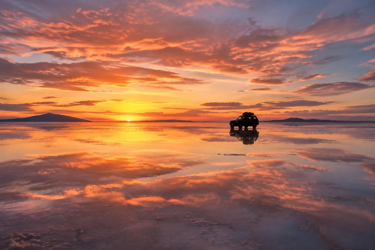
Most photos of Bolivia’s salt flat show one of two faces: a sky reflected in a thin sheet of water, or an endless white floor cracked into hexagons. The second one is the Salar de Uyuni dry season, and for roughly seven months a year (May to November) it is the version of the salt flat that most travelers actually see. It is also the version that lets you go the farthest: deep into the flat, out to Incahuasi Island, up the slopes of Tunupa volcano and south through the high lagoons to the Chilean border.
We grew up in Bolivia, and the question we hear most from friends planning a trip is simple: “Is the dry season worth it if there is no mirror?” Our honest answer is yes, as long as you know what you are signing up for. The days are bright and dry, the roads across the salt are open, and the skies at night are some of the clearest on the planet. The trade-off is cold, real cold, especially from June to August and especially on multi-day trips south.
In this guide we break the season down month by month (temperatures, wind, crowds and what you can visit), explain why the salt forms hexagons, list the places you can only reach when the flat is dry, and give you a straight comparison with the rainy season so you can decide which one fits your trip.
Quick answer: The Salar de Uyuni dry season runs from about May to November. Expect sunny days of roughly 12-20 °C, nights well below freezing (colder on the southern lagoon circuit, where -15 °C or lower is possible in June-August), a hard white surface with hexagon patterns, full access to Incahuasi Island and the center of the flat, excellent stargazing, and no mirror effect. July and August are the busiest and coldest months; September to early November are milder and quieter.
What “dry season” means on the Salar de Uyuni
The Salar de Uyuni covers about 10,500 km² at roughly 3,650 m above sea level in the Potosí Department of southwest Bolivia. From around December to April, summer rains from the Amazon side of the continent reach the Altiplano and leave a shallow layer of water on parts of the flat. That water is what creates the famous mirror. We cover that period in detail in our guide on when to see the mirror effect.
Once the rains stop, the strong sun, low humidity and constant wind evaporate the water within a few weeks. By May most of the surface is dry, and from June onward it is usually rock hard from edge to edge. In practice, “dry season” on the salt flat means three things:
- The surface is solid. Land cruisers can drive straight across the flat at speed, which opens routes that are blocked or risky when the salt is wet.
- The sky is clear almost every day. Rainfall in Uyuni is close to zero from June to August, and cloud cover is at its lowest of the year around August.
- The temperature swing is huge. Thin, dry air at 3,650 m heats quickly in the sun and loses that heat as soon as the sun goes down. A 20-25 °C difference between afternoon and pre-dawn is normal.
If you want the general basics first (exactly where the salt flat is, the weather year-round, money and what to wear), our overview section on where the Salar de Uyuni is and how the weather works is a good starting point.
Why the salt forms hexagons
The hexagons are the signature image of the dry season, and they have a real scientific explanation. For years people assumed the shapes were simple drying cracks, like mud in a puddle. A study by a team led by Jana Lasser, published in Physical Review X in 2023, showed something more interesting: the patterns are driven by what happens under the surface.
Below the crust of the Salar lies a layer of very salty groundwater. When the sun evaporates water at the surface, the water near the top becomes saltier and heavier than the water below. Heavier water sinks, lighter water rises, and the result is slow circulation in the ground, called convection. These circulating cells pack together in the most efficient way possible, which is close to a hexagon. Along the edges, where the saltiest water sinks, extra salt crystallizes and builds up into the raised ridges you see and walk on.
That same research explains why the polygons on salt flats around the world tend to measure about one to two meters across. On the Salar de Uyuni you will notice the ridges are sharper and taller in some areas than others. They are usually most defined in the drier, central parts of the flat, and best photographed in the low light of early morning or late afternoon, when shadows make the edges stand out.
Tips for photographing the hexagons
- Shoot low. Put your phone or camera close to the ground so the ridges lead toward the horizon.
- Use side light. At midday the salt looks flat and white; one or two hours after sunrise the pattern pops.
- Wear sunglasses while you frame. The glare off the salt is intense, and your eyes tire quickly.
- Do not scrape or take salt from the ridges. Small actions repeated by thousands of visitors a year do damage.
Month-by-month: the Salar de Uyuni from May to November
Temperature figures for Uyuni vary between sources because there are few official stations on the flat and conditions change a lot with altitude. The table below gives realistic ranges based on long-term climate averages for Uyuni town and the experience of tour operators. Lagoon-circuit nights refer to the lodges around Laguna Colorada and Huayllajara (about 4,300 m), which are much colder than Uyuni.
| Month | Day high (Uyuni) | Night low (Uyuni) | Night low (lagoons, ~4,300 m) | Wind | Crowds | What you can visit |
|---|---|---|---|---|---|---|
| May | 14-17 °C | -2 to -7 °C | -10 to -15 °C | Moderate, rising | Low to medium | Almost everything; a few damp patches may remain early in the month |
| June | 12-13 °C | -3 to -13 °C | -15 to -20 °C | Moderate | Medium, rising late month | Full access; occasional snow on the southern route |
| July | 11-14 °C | -3 to -11 °C | -15 to -20 °C or lower | Moderate to strong | High (peak) | Full access; snow can briefly close passes near Chile |
| August | 12-14 °C | -3 to -12 °C | -15 to -20 °C | Strong, gusty afternoons | High | Full access; clearest skies of the year |
| September | 15-17 °C | -2 to -10 °C | -10 to -15 °C | Strongest of the year | Medium | Full access; dusty afternoons possible |
| October | 16-19 °C | 0 to -8 °C | -8 to -12 °C | Strong, easing | Medium to low | Full access; one of our favorite months |
| November | 18-20 °C | +2 to -3 °C | -5 to -10 °C | Moderate | Low | Full access early; first storms possible late in the month |
Sources such as WeatherSpark put the average low in Uyuni town around -3 °C in winter, while operators on the ground regularly report -10 °C or colder on clear nights, and much lower in the south. Plan for the colder end of every range.
May: the transition month
May is a good compromise. The water is gone from most of the flat, prices and crowds have not yet peaked, and the cold has not reached its worst. In some years, after a wet summer, you can still find shallow wet spots in the first weeks, which occasionally allows a small reflection near the edges. Do not count on it.
June: cold settles in
June brings the first truly freezing nights. Days are still sunny and pleasant in a jacket, and the hexagons are usually well formed by now. Toward the end of the month, northern-hemisphere summer travelers and Bolivian winter school holidays start to fill tours.
July and August: peak season, peak cold
These are the busiest months on the salt flat. You will share the popular photo spots with dozens of other vehicles, especially at the Dakar monument, the salt hotel area and Incahuasi around midday. They are also the coldest months. Snowfall is possible on the southern circuit, and occasionally passes near the Chilean border close for a day or two. Wind picks up in August. The upside: the clearest skies of the year and excellent stargazing.
September and October: the sweet spot
Crowds drop after August, nights start to soften, and days reach the high teens. September is often the windiest month, so expect gusts and dust in the afternoons on the lagoon circuit. October is calmer, and for many travelers it is the best balance of comfort, cost and access.
November: the end of the dry
Days are warm by Altiplano standards (around 18-20 °C) and nights are the mildest of the season. Late in the month the first afternoon storms can roll in. The flat stays dry for most of November, so it is a good choice if you want warmer weather and fewer people.
🗺️ BOOK YOUR SALAR TOUR
Cross the dry salt flat with local licensed guides
The full-day Salar excursion covers the train cemetery, Colchani, the hexagons, Incahuasi Island and sunset, with lunch and transport from Uyuni included.
Check availability →✓ Free cancellation on most tours · ✓ Instant confirmation · ✓ Local operators
Highlights you can only reach in the dry season
The biggest practical advantage of visiting between May and November is access. When the salt flat is wet, drivers stay close to the edges near Colchani to protect their vehicles (salt water destroys engines and chassis) and to avoid getting stuck. When it is dry, the whole flat opens up.
Incahuasi Island and its giant cacti
Incahuasi Island sits roughly in the middle of the Salar, about 80 km west of Colchani. It is the top of an old volcano, covered in fossilized coral-like formations from the time when this area was part of a prehistoric lake, and home to hundreds of giant cacti (Trichocereus pasacana, also called Echinopsis atacamensis). Some of them are over 10 m tall. Since these cacti grow only about 1 cm per year, the biggest ones are many centuries old.
A loop trail of about 1 km climbs to the top of the island, where you get a 360-degree view of white salt in every direction. At a relaxed pace, which is the right pace at this altitude, it takes 30-45 minutes. The entrance fee is around 30 Bs per person, paid in cash (bolivianos) at the entrance. It is usually not included in tour prices, and fees do change, so carry small bills.
In the rainy season, jeeps often cannot reach the island safely, and drivers substitute closer stops. In the dry season, Incahuasi is a standard part of almost every full-day tour and of day one on the 3-day and 4-day trips. Many tours eat lunch at tables on the salt near the island.
Driving deep into the flat
There is something about being in the middle of the Salar, with nothing on any horizon but white, that photos never quite capture. In the dry season, drivers can head far from the tourist cluster near Colchani to quieter areas with untouched hexagons. Private tours in particular can ask to stop away from other groups. If you value space and silence, a private Salar excursion gives you more control over where and how long you stop.
Tunupa volcano and the Coquesa mummies
Tunupa is a dormant volcano of about 5,320 m on the north shore of the Salar, its slopes striped in red, orange and yellow mineral bands. At its base is the small village of Coquesa (also spelled Coqueza). In the dry season you can cross the flat to reach it; when the flat is flooded, getting there means a long detour by land.
Above Coquesa, a cave holds a group of chullpas, or mummies, believed to be around 500 years old and well preserved by the dry, cold air. The fee for the mummies is around 30 Bs, paid at the visitors’ office in the village. From the village, a trail climbs to a viewpoint over the Salar; reaching the first viewpoint takes about two hours on foot. Most standard 3-day tours do not include Tunupa, so ask your operator in advance or consider an overnight stay in one of the villages on the north shore.
Tunupa also has a special place in Aymara tradition. Local legends say the Salar itself was formed from the tears and milk of Tunupa, a figure from the mountain stories that grandparents still tell in the region.
Perspective photos
The famous “tiny person standing on a giant’s hand” photos only work on a dry, flat, featureless surface. The uniform white removes depth cues, so objects close to the camera look huge next to people far away. Drivers on most tours are experienced at setting these up, and many bring props (a toy dinosaur is a classic). A few tips:
- Keep the camera very low, almost on the salt, and use a small aperture or your phone’s main lens for maximum depth of field.
- Have the far person stand 10-20 m away; they will need to move by small steps while you look at the screen.
- Midday light works best for these, unlike the hexagon shots.
- Plan the ideas before you go. Thinking of poses on the spot wastes time.
The cold of June to August on multi-day trips south
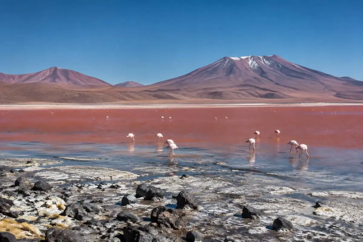
A day tour on the Salar in July is cold in the early morning and comfortable at noon. A multi-day tour south is a different experience. After the salt flat, the classic route climbs into the Eduardo Avaroa Andean Fauna National Reserve, past colored lagoons with flamingos, toward the Chilean border. Most of the route runs above 4,000 m, and the highest point, the Sol de Mañana geyser field, sits at about 4,850-4,900 m.
What a typical cold-season route looks like
- Day 1: train cemetery, Colchani, the salt flat, Incahuasi Island. Night in a salt hotel or basic lodge on the edge of the flat (about 3,650-3,700 m).
- Day 2: volcano views (Ollagüe), high lagoons such as Cañapa and Hedionda, the Siloli desert and the Árbol de Piedra rock formation, then Laguna Colorada (about 4,300 m) with its red water and flamingos. Night in a basic refugio near the lagoon.
- Day 3: pre-dawn departure to the Sol de Mañana geysers (about 4,900 m), a dip in the Polques hot springs, Salvador Dalí desert, Laguna Verde under Licancabur volcano. Return to Uyuni or transfer to the Chilean border for San Pedro de Atacama.
The Eduardo Avaroa reserve entrance fee is about 150 Bs per person, cash only, and the hot springs charge a small extra fee (roughly 6-30 Bs). These are generally not included in tour prices. For a detailed comparison of the routes, read our breakdown of 1-day vs 3-day vs 4-day tours.
How cold the nights really get
The second night, near Laguna Colorada, is the hard one. The refugios in this area are simple: shared rooms, thick blankets, limited or no heating, and showers that may be cold or cost extra. Electricity often runs on a generator for a few hours in the evening. In June, July and August, outside temperatures regularly fall to -15 °C, and on some nights toward -20 °C or lower at higher points. Inside an unheated room, it can still be below freezing by morning. Water bottles left by the window freeze.
Then comes the pre-dawn start to the geysers, often leaving around 5:00 am to arrive near sunrise, when the steam columns are most visible. At almost 4,900 m, before the sun is up, this is the coldest moment of the whole trip. Wind chill makes it feel colder still.
How to stay warm (and sleep)
- Layers, not one heavy coat. A thermal base layer (merino or synthetic), a fleece, and a down or synthetic insulated jacket. You will add and remove layers many times a day.
- Sleep in your base layer, hat and socks. A sleeping bag liner adds a few degrees to a rented bag or lodge blankets. Many operators rent sleeping bags for a small fee; ask when you book.
- Protect your extremities. Warm gloves, wool socks, a beanie and a buff or neck gaiter make the biggest difference at the geysers.
- Keep batteries warm. Phones and camera batteries drain fast in the cold. Keep them in an inside pocket and sleep with them in your bag.
- Drink water and go easy. Altitude and dry air dehydrate you quickly. Eat light at night, avoid alcohol on the first nights and walk slowly.
Our full list is in the guide on what to pack for the Salar de Uyuni, with separate notes for day trips and multi-day tours.
🧥 COLD-WEATHER GEAR
Pack for -15 °C nights at the lagoons
A packable down jacket, a thermal base layer and a sleeping bag liner are the three items that matter most on a June-August trip.
Shop warm layers →✓ Lightweight and packable · ✓ Fast shipping before your trip · ✓ Easy returns
Stargazing in the dry season
If there is one reason to brave the cold, it is the night sky. The combination of high altitude, extremely dry air, almost no light pollution and clear weather makes the dry season one of the best times anywhere in South America to look up. August has the clearest skies of the year in Uyuni, and June to September is also when the bright central part of the Milky Way rides high in the evening sky in the southern hemisphere.
Some practical notes:
- Check the moon. The darkest skies are in the days around the new moon. A full moon lights up the white salt so brightly that the Milky Way fades.
- Book a stargazing tour or a sunset-and-stars tour. Several operators in Uyuni run evening trips onto the flat that stay after sunset. Ask whether the return is after dark.
- Dress for the geysers. At 10 pm on the salt in July, it can already be -10 °C. Bring every layer you own.
- On multi-day tours, step outside the lodge for ten minutes on the second night. You do not need a tour for the stars at Laguna Colorada.
For photographers, a tripod is essential. In the rainy season you can capture stars reflected in water, but those nights are often cloudy. The dry season trades the reflection for many more clear nights.
Dry season vs rainy season: side by side
Neither season is “better.” They are different trips. This table sums up the main differences so you can choose by what matters most to you.
| Factor | Dry season (May-Nov) | Rainy season (Dec-Apr) |
|---|---|---|
| Surface | Hard white salt with hexagons | Shallow water in parts; mirror effect best Jan-Mar |
| Day temperature | About 12-20 °C (coolest Jun-Aug) | About 17-21 °C |
| Night temperature (Uyuni) | Well below freezing, often -5 to -12 °C in midwinter | Around 0 to 5 °C |
| Incahuasi Island | Accessible on standard tours | Often unreachable |
| Deep flat and Tunupa crossing | Open | Limited to edges; long detours |
| Southern lagoons and geysers | Open; possible snow closures Jun-Aug | Open; storms and muddy tracks possible |
| Perspective photos | Ideal | Only on dry patches |
| Stargazing | Excellent, many clear nights | Star reflections possible but frequent clouds |
| Crowds | Peak Jul-Aug, quieter May and Sep-Nov | Busy around Christmas, New Year and Carnival |
| Flights and roads to Uyuni | Generally reliable | Occasional delays from storms |
| What to bring | Down jacket, thermals, liner, sunglasses, sunscreen | Rubber boots (often provided), rain layer, sunscreen |
If the reflection is your main goal, go between January and March. If you want the widest range of places, solid roads, the hexagons and dark skies, go between May and November. And if you want a bit of both, the shoulder weeks in April and early May sometimes offer leftover water near the edges and a dry center, although nature does not follow a calendar.
🦩 SALT FLAT + LAGOONS + GEYSERS
The classic 3-day dry-season route
Incahuasi, Laguna Colorada, the Sol de Mañana geysers and Laguna Verde in one trip, with 4×4 transport, driver-guide, meals and lodging included.
See the 3-day tour →✓ Free cancellation on most tours · ✓ Instant confirmation · ✓ Local operators
Who should go in the dry season
The dry season is a good fit for most travelers, but especially for these groups:
- Travelers crossing to or from Chile. The classic 3-day route to San Pedro de Atacama (or the reverse) runs through the dry high desert and is most reliable from May to November, outside of short snow closures.
- Photographers who want variety. Hexagons, perspective photos, cacti, flamingos, geysers and the Milky Way, all in a few days.
- Travelers with limited time. With Incahuasi accessible, a single full-day tour shows you much more of the Salar than in the wet months.
- People who want to see the “real” Altiplano. The dry season shows the region’s geology, wildlife and villages at their clearest.
- Anyone traveling during northern-hemisphere summer holidays. July and August are the coldest months, but with good gear they are very doable.
Who might prefer another time? If you have a strong sensitivity to cold, or are traveling with small children or elderly relatives, a June-August multi-day trip south can be tough. A day tour from Uyuni plus a night in one of the salt hotels near the Salar (many have heating) is a gentler option. Or choose September to November, when nights are milder. And if your dream is the mirror, the dry season will disappoint you no matter what.
Altitude: the same in every season
Altitude is not seasonal, but the cold can make its effects feel worse. Uyuni sits at about 3,670 m and the southern route goes above 4,800 m. Spend at least a day or two at altitude before the tour if you can (La Paz, Sucre or Potosí are good places to adjust), drink plenty of water and talk to your doctor before traveling if you have heart or lung conditions. Our guide on how to get to Uyuni from La Paz explains the flight (about 1 hour), overnight bus (about 10-12 hours) and train options, which also help you plan a gradual climb.
Recommended dry-season tours
All the tours we recommend are booked through Civitatis and operated by local licensed Bolivian companies. You can see all the options in our tours section. Here is how they fit the dry season:
Full-day Salar excursion (best for short trips)
The standard full-day tour from Uyuni visits the train cemetery, the salt-processing village of Colchani, the hexagon fields, the Dakar monument and flag area, and Incahuasi Island, with lunch on the salt. Most return after sunset. In the dry season this is the most complete single day you can spend on the flat. Book the Salar de Uyuni day excursion if you only have one day.
3-day Salar and deserts (best for most travelers)
This is the classic route described above: salt flat, lagoons, geysers and Laguna Verde. It ends either back in Uyuni or at the Chilean border. It is the best value way to see the whole region, and it is the trip where cold-weather preparation matters most between June and August.
4-day Uyuni tour ending in La Paz (best for a one-way itinerary)
The 4-day Uyuni tour adds more time and finishes in La Paz, which saves you a separate trip back. It suits travelers who want a slower pace (helpful for acclimatization) and who are continuing their trip in northern Bolivia, such as Lake Titicaca.
Private excursion (best for families and photographers)
A private tour lets you set the timing: stay longer for sunset or stars, skip crowded stops and head to quieter parts of the flat. For families with kids or older travelers, that flexibility can make the cold easier to manage.
🏔️ SLOWER PACE, ONE-WAY ROUTE
4 days from Uyuni, ending in La Paz
More time to adjust to the altitude and the cold, plus no backtracking to Uyuni at the end of your trip.
Check dates →✓ Free cancellation on most tours · ✓ Instant confirmation · ✓ Local operators
Where to sleep and other practical tips
Uyuni town has a range of hotels, from simple guesthouses to comfortable mid-range options. In July and August, book early, and look specifically for rooms with heating, since many budget places have none. On the edge of the flat near Colchani you will find the salt hotels, built from salt blocks. You can compare options and prices on Booking.com.
A few more practical notes for the season:
- Carry cash. Entrance fees (Incahuasi, Eduardo Avaroa reserve, hot springs, Coquesa) are paid in bolivianos (BOB). Bring small bills; ATMs are limited outside Uyuni and absent on the route south.
- Sun protection. The UV at this altitude is strong year-round, and the salt reflects it. Use high-SPF sunscreen, lip balm and good sunglasses even when it is cold.
- Moisturizer. The air is so dry that lips and hands crack quickly.
- Snow closures. In June to August, the road near the Chilean border occasionally closes for a day or two after snow. If you have a flight from Calama or a fixed date in Chile, leave a buffer day.
- Travel insurance. Remote roads, high altitude and limited medical facilities make insurance a sensible choice. Check that your policy covers altitude and emergency evacuation.
Still unsure about something? You can send us a question through our contact page, and we answer on WhatsApp. To learn who we are and why we started this guide, see our about page.
🛡️ TRAVEL INSURANCE
Travel protected on remote Altiplano roads
SafetyWing offers flexible travel medical insurance for trips through Bolivia and Chile, easy to buy even after you leave home. Always read the policy for altitude limits.
Get a quote →✓ Buy online in minutes · ✓ Covers many countries · ✓ Monthly or trip-based
Frequently Asked Questions
When is the dry season at the Salar de Uyuni?
The dry season runs from about May to November. Rainfall is close to zero from June to August, and the salt surface is usually completely dry and hard from June until the first storms in late November or December.
Can you see the mirror effect in the dry season?
Generally no. The mirror needs a thin layer of water on the salt, which only happens in the rainy season (best from January to March). In early May, after a wet year, small wet patches near the edges can sometimes give a limited reflection, but it is not reliable.
How cold is the Salar de Uyuni in July?
Days in July are sunny and reach about 11-14 °C. Nights in Uyuni typically fall to between -3 and -11 °C, and at the lodges near Laguna Colorada on multi-day tours they can reach -15 to -20 °C or lower.
Why does the salt form hexagons?
Research published in Physical Review X in 2023 showed the hexagons come from slow convection of salty groundwater under the crust. Salt crystallizes where the saltiest water sinks, building ridges that form polygons about one to two meters across.
Is Incahuasi Island open in the dry season?
Yes. In the dry season Incahuasi Island is accessible on almost every full-day and multi-day tour. The entrance fee is about 30 Bs per person, paid in cash, and is usually not included in the tour price. In the rainy season it is often unreachable.
What is the best month to visit in the dry season?
For many travelers, September and October offer the best balance: milder nights than midwinter, fewer crowds than July and August, and full access to every site. May is also good. July and August have the clearest skies but are the coldest and busiest.
Do I need a sleeping bag for the 3-day tour?
Lodges provide blankets, but from June to August a sleeping bag (often rentable from the operator) or at least a thermal sleeping bag liner makes a big difference on the second night near Laguna Colorada, where rooms are usually unheated.
How high are the Sol de Mañana geysers?
The Sol de Mañana geyser field sits at about 4,850-4,900 m, the highest point on the classic 3-day route. Tours usually arrive around sunrise, which is also the coldest part of the day.
Is the dry season good for stargazing?
Yes, it is the best time of year. Skies are clear on most nights, especially from June to September, and August is the clearest month. Plan your nights around the new moon for the darkest sky.
Can I visit Tunupa volcano and the Coquesa mummies on a standard tour?
Most standard 3-day tours skip them, but some operators and private tours include them in the dry season, when the flat can be crossed to the north shore. The mummies fee is around 30 Bs, and the climb to the first viewpoint takes about two hours.
Conclusion: plan your dry-season trip with the cold in mind
The Salar de Uyuni dry season shows the salt flat at its most open. You can drive to its center, walk among centuries-old cacti on Incahuasi, cross to the colored slopes of Tunupa, play with perspective on the hexagons and spend nights under some of the darkest skies in South America. The cost is cold, and in June to August it is serious cold, especially on the lagoon circuit south. Pack properly, choose your month with the crowds and temperatures in mind, and you will come home with a very different picture of Bolivia than the one in the mirror photos.
Ready to go? Start with the full-day Salar tour if you are short on time, or the 3-day salt flat and deserts route if you want to see it all. Browse more ideas on our home page, and if you have questions about dates or gear, write to us. We are happy to help.